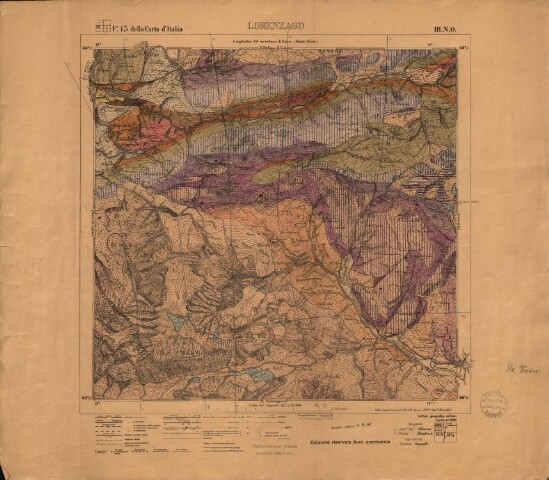
Rilevamento geologico di Lorenzago
Descrizione
Rilevamento disegnato sulla base di: Lorenzago - Foglio 13 della Carta d'Italia, III. N.O., scala 1:25 000 (S.l.: IGM, 1888 - ediz. riservata fuori commercio).
Firma di Antonio De Toni sul lato destro della carta
Le stelle rosse indicano le zone fossilifere, descritte da De Toni nello studio sulla fauna triassica di Valdepena.
Persone
Biblioteca di Geoscienze - Università di Padova (Autore della digitalizzazione)
De Toni, Antonio (Cartografo)
Luogo/Tempo
1914?
Formato
image/jpeg (59.34 MB)
mappa (altezza: 510 mm, larghezza: 585 mm)
Soggetto
• Antonio De Toni
