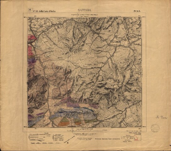
Rilevamento geologico di Sappada
Descrizione
Rilevamento disegnato sulla base di: Sappada - Foglio 13 della Carta d'Italia, IV. S.E., scala 1:25.000 (S.l.: IGM, 1889 - ediz. riservata fuori commercio). Firma di Antonio De Toni sul lato destro della carta
Persone
Biblioteca di Geoscienze - Università di Padova (Autore della digitalizzazione)
De Toni, Antonio (Cartografo)
Luogo/Tempo
1914?
Formato
image/jpeg (58.68 MB)
mappa (altezza: 580, larghezza: 510)
Soggetto
• Antonio De Toni
